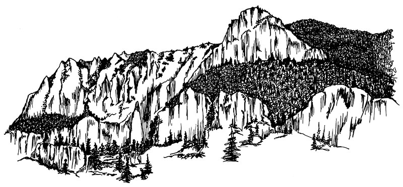
Volcanic activity occurred throughout the Silver Thread region. The cliffs on the east side of the river, known as the Palisades, were formed after cooled and hardened volcanic debris shrank to form intersecting cracks, similar to how a drying mud puddle shrinks. These cracks separated the bedrock into the columns that you see today. In Creede and Lake City, the cracks were filled with the precious minerals later discovered by prospectors.

03 the Palisades

contentmap_plugin

Credits and Acknowledgments

The research, writing and production of this interpretive booklet were made possible by grants from the following generous organizations: Federal Highway Administration Intermodal Surface Transportation Efficiency Act (ISTEA), colorado Historical Society, Western Colorado Interpretive Association (WCIA), Hinsdale County Lodging Tax Panel, Lake City Chamber of Commerce, the Creede and Mineral County Chamber of Commerce, the Silver Thread Scenic and Historic Byway Council, and the Rio Grande Watershed Emergency Action Coordination Team. Special thanks to Grant Houston of the Hinsdale County Historical Society, Lynna Jackson of Creede, Nancy Houston, and the authors, Laurene Farley and Sandy Thompson of the U.S. Forest Service, Gunnison, Colorado. Layout and design update by B4 Studio, Creede.