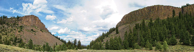
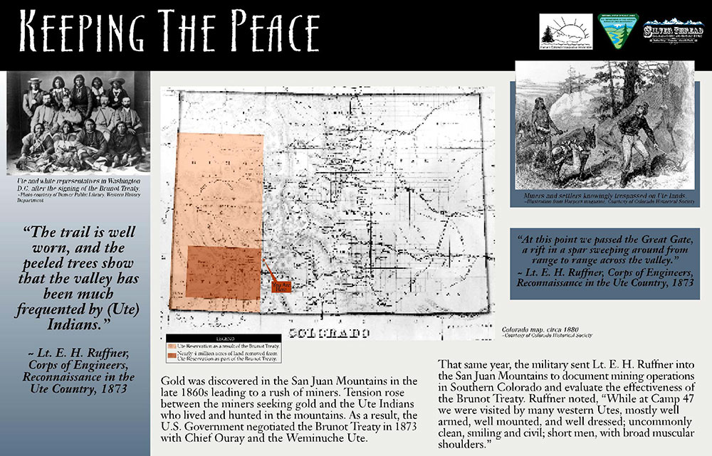
These majestic cliffs on both sides of the highway may have been a welcome landmark for pioneers entering Lake Fork Valley from the north. Corps of Engineers Lieutenant E. H. Ruffner in his “Reconnaissance in the Ute Country, Season of 1873” report describes the formation as:

The “Gateway” is about 500 feet high and of basalt. The upper 50 to 200 feet is [sic] perpendicular cliff, below which slopes of huge sharp-angled rocks, resembling the Palisades of the Hudson, columnar and regular...

the gate

Silver Brunot Treaty

contentmap_plugin

Credits and Acknowledgments

The research, writing and production of this interpretive booklet were made possible by grants from the following generous organizations: Federal Highway Administration Intermodal Surface Transportation Efficiency Act (ISTEA), colorado Historical Society, Western Colorado Interpretive Association (WCIA), Hinsdale County Lodging Tax Panel, Lake City Chamber of Commerce, the Creede and Mineral County Chamber of Commerce, the Silver Thread Scenic and Historic Byway Council, and the Rio Grande Watershed Emergency Action Coordination Team. Special thanks to Grant Houston of the Hinsdale County Historical Society, Lynna Jackson of Creede, Nancy Houston, and the authors, Laurene Farley and Sandy Thompson of the U.S. Forest Service, Gunnison, Colorado. Layout and design update by B4 Studio, Creede.