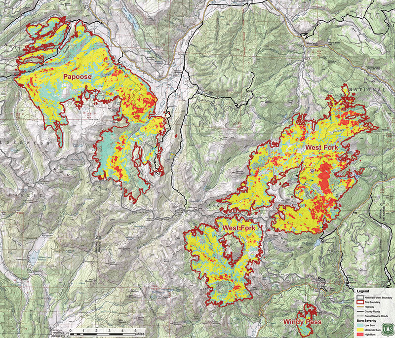
In mid-June of 2013, the West Fork Wildfire Complex burned 109,000 acres (179 square miles) on mostly public lands. One section of this fire, The Papoose, burned along the Silver Thread Scenic & Historic Byway, and came close to the highway along this stretch. The intensity of the fire (it burned 11,000 acres in one day at this location!) and its proximity to Creede, Lake City, and South Fork had an enormous and devastating impact on the area’s economy and landscape.  Learn more at www.rweact.org 

PapooseMap rweact

PapooseFire Travis Smith
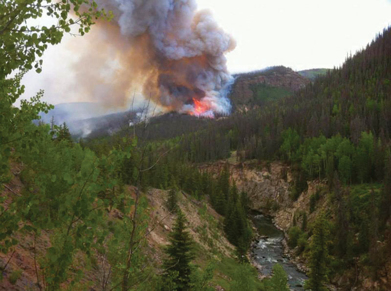
Papoose Fire, courtesy Travis Smith

PapooseFire B4Studio
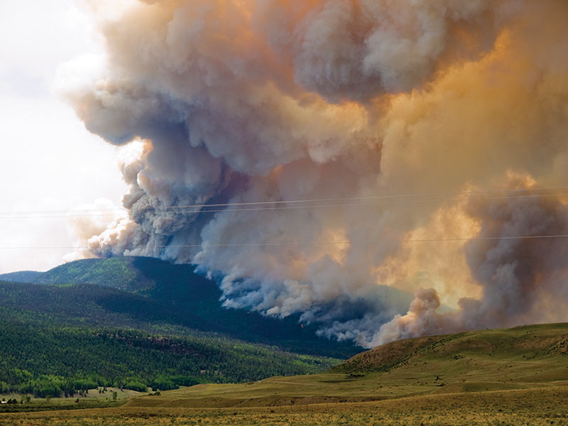
Papoose Fire, courtesy b4Studio

contentmap_plugin

Credits and Acknowledgments

The research, writing and production of this interpretive booklet were made possible by grants from the following generous organizations: Federal Highway Administration Intermodal Surface Transportation Efficiency Act (ISTEA), colorado Historical Society, Western Colorado Interpretive Association (WCIA), Hinsdale County Lodging Tax Panel, Lake City Chamber of Commerce, the Creede and Mineral County Chamber of Commerce, the Silver Thread Scenic and Historic Byway Council, and the Rio Grande Watershed Emergency Action Coordination Team. Special thanks to Grant Houston of the Hinsdale County Historical Society, Lynna Jackson of Creede, Nancy Houston, and the authors, Laurene Farley and Sandy Thompson of the U.S. Forest Service, Gunnison, Colorado. Layout and design update by B4 Studio, Creede.